Suburbs don’t change by accident, they change when jobs, transport and amenities arrive. Understanding how infrastructure reshapes an area helps buyers read a growth corridor realistically, without over‑relying on marketing. This guide explains the mechanisms and how to verify them.
How infrastructure reshapes a suburb
Four levers do most of the work:
- Access (transport): new rail, roads and bus links cut travel times and widen the catchment for jobs and services.
- Jobs (employment): employment precincts bring workers who want to live nearby, supporting local demand.
- Amenity (community infrastructure): schools, health, town centres, parks and retail lift liveability.
- Utilities & capacity: water, sewer, power and telecommunications unlock land for housing.
Types of infrastructure to watch
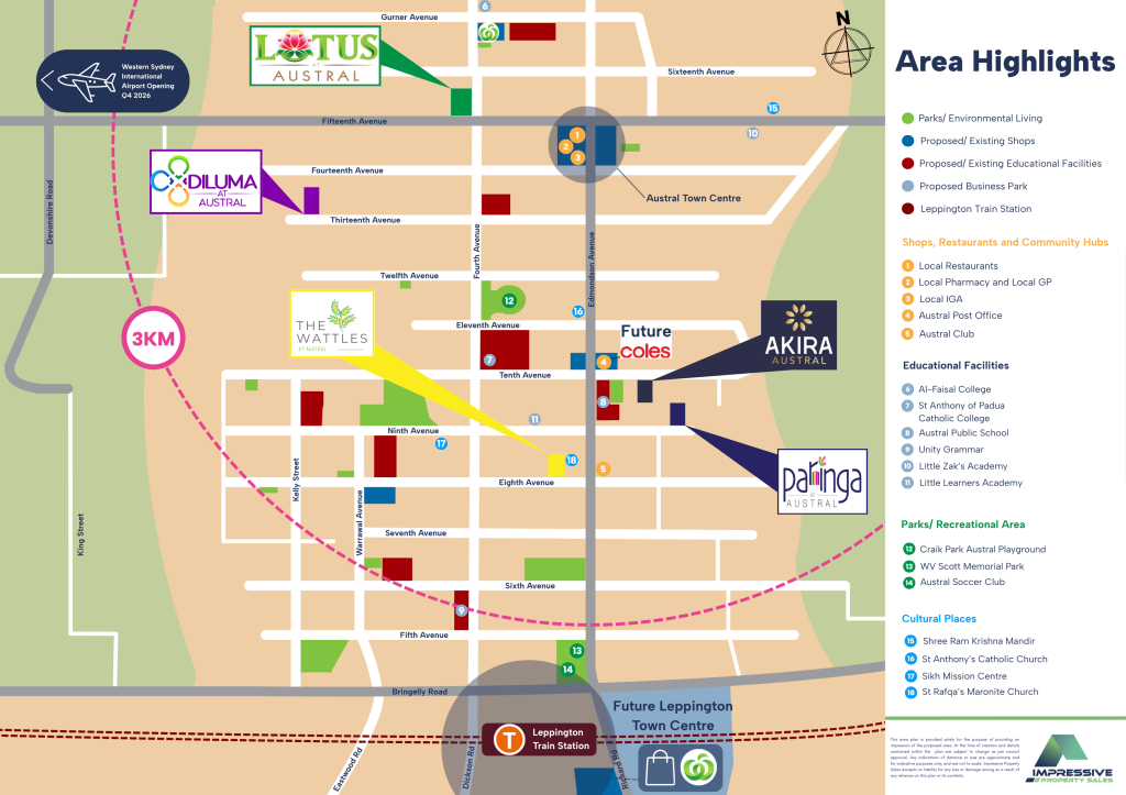
- Transport: e.g., the Sydney Metro – Western Sydney Airport line, the M12 Motorway, the Outer Sydney Orbital corridor.
- Employment anchors: the Western Sydney International (Nancy‑Bird Walton) Airport and the Aerotropolis / Bradfield City.
- Social: committed schools, hospitals and town centres.
Committed vs Proposed
Not all “coming soon” is equal. Funded, government‑committed projects (with a delivery agency and timeline) are far stronger signals than “proposed” or “future” concepts. Always verify status with the responsible agency.
Lead times and staging
Major infrastructure rolls out over years, and benefits arrive in stages. A realistic buyer looks at delivery timelines, not just announcements and understands that suburbs mature gradually as projects complete.
What this means for liveability and demand
As access, jobs and amenity improve, an area can become more liveable and more sought‑after over time. We make no price predictions here but the drivers of demand are observable and verifiable, which is what buyers should focus on.
What buyers should do
- Identify the committed infrastructure near a block and its timeline.
- Weigh transport + jobs + amenity together, not in isolation.
- Confirm everything with official NSW sources below.
🏛️ Official NSW Framework Check
- Transport for NSW: committed transport projects & timelines.
- NSW Planning: precinct plans & growth‑area delivery.
- Western Parkland City Authority: Aerotropolis / Bradfield.
Reading suburb change
| Lever | Signal to verify | Source |
|---|---|---|
| Access | Funded rail/road nearby | Transport for NSW |
| Jobs | Committed employment precincts | NSW Planning / WPCA |
| Amenity | School/health/centre timelines | NSW Planning / council |
| Capacity | Servicing & land release | Sydney Water / NSW Planning |
👉 Understand a suburb’s trajectory
Ask us for a factual read on the infrastructure shaping a specific area, Call Us @ 1300 823 796
References
- Transport for NSW — committed projects — transport.nsw.gov.au
- NSW Department of Planning, Housing and Infrastructure — precincts & growth areas — planning.nsw.gov.au
- Western Parkland City Authority — wpca.sydney
- Western Sydney International Airport — wsiairport.com.au
Disclaimer: General information only, current as at the date of publication. Not legal, financial or planning advice, and it does not consider your circumstances. Planning controls, hazard mapping and legislation change over time — verify the current position with the relevant NSW authority and obtain advice from a licensed conveyancer/solicitor and other qualified professionals before acting. Impressive Property Developments accepts no liability for reliance on this information.